
Prev | Next
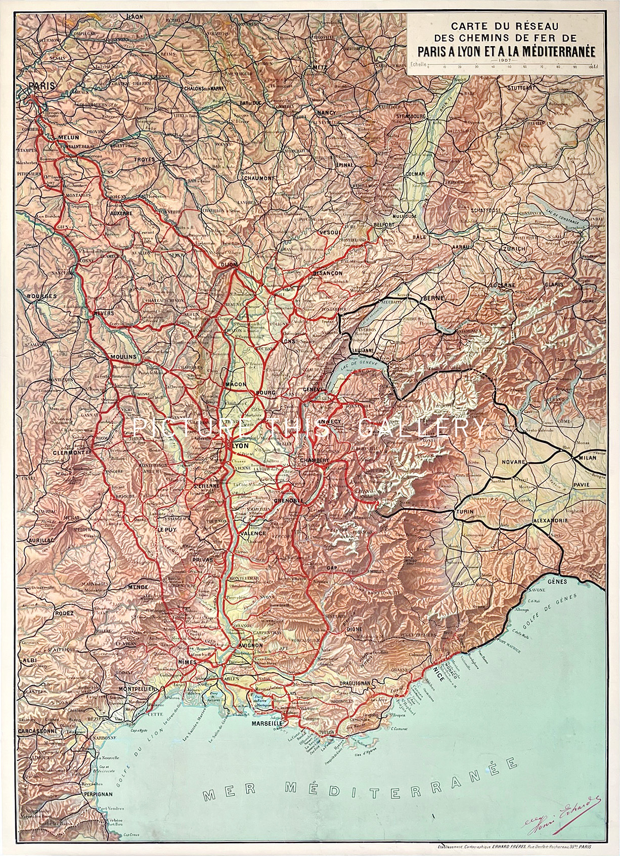
Carte du Réseau des Chemins de Fer de Paris a Lyon et a la Méditerranée (1926)
Henri Erhard
Institut Cartographique de Paris, Paris
Offset printing
76cm x 105cm
1926
Grade: B, Good. Linenbacked. Restored tears (no loss) at the bottom in the sea. Restored borders
M0674
Map of the railway network from Paris to Lyon and the Mediterranean.
80
RECENTLY VIEWED ITEMS

Picture This - Online Art Gallery
Operating from the United Kingdom
Tel : +44 7925 178151
Email : info at picturethiscollection.com


OUR COMPANY
About Us
Contact Us
Press Room
Site Map
OUR SERVICES
Sell to Us
Search and Source
Art Consultancy
Gift Certificates
Terms & Conditions / Privacy Policy
PDF Links 2021
FAQs

Copyright 2025 Picture This International Limited. All Rights Reserved
Powered by Hodfords