


Prev | Next
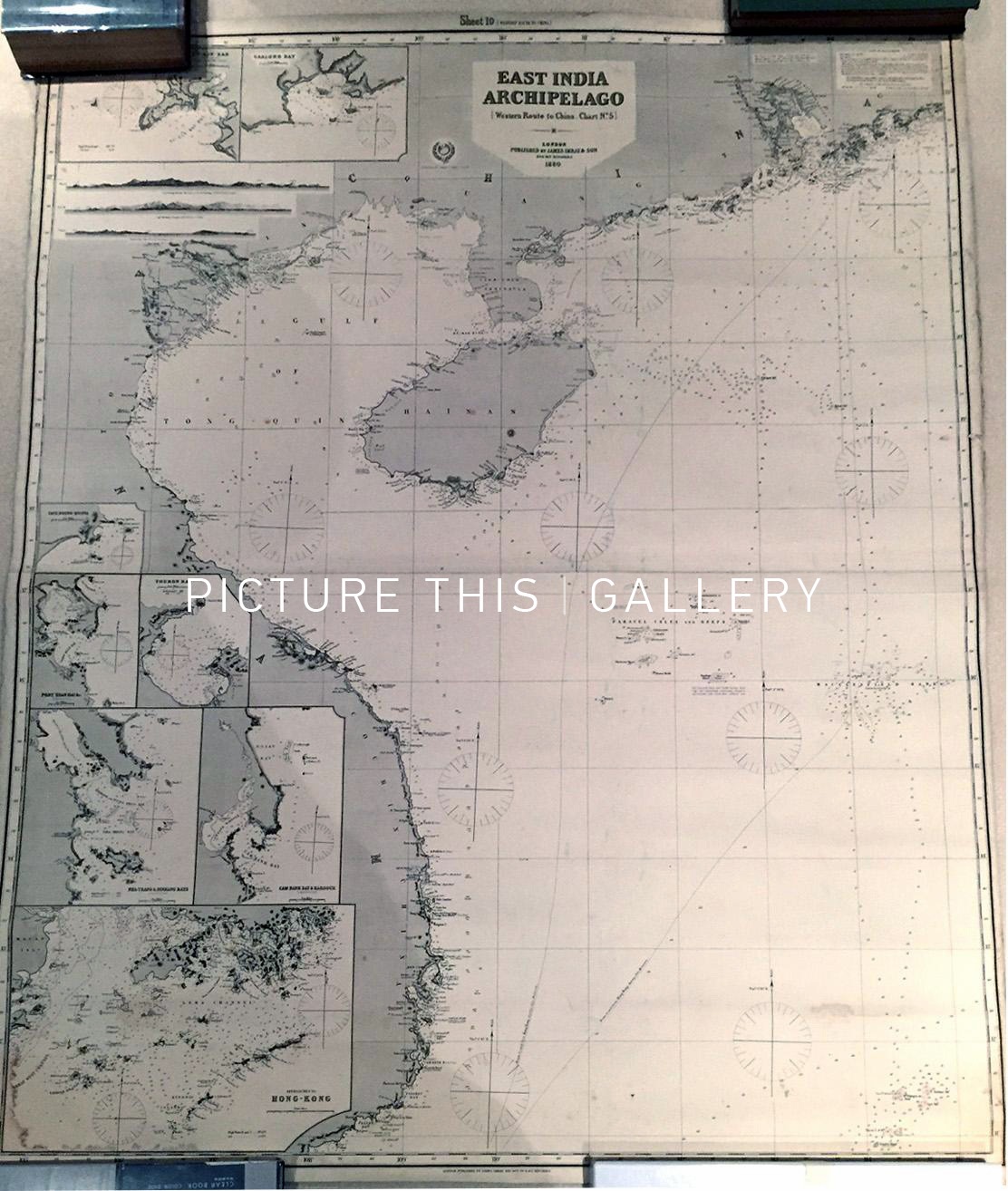
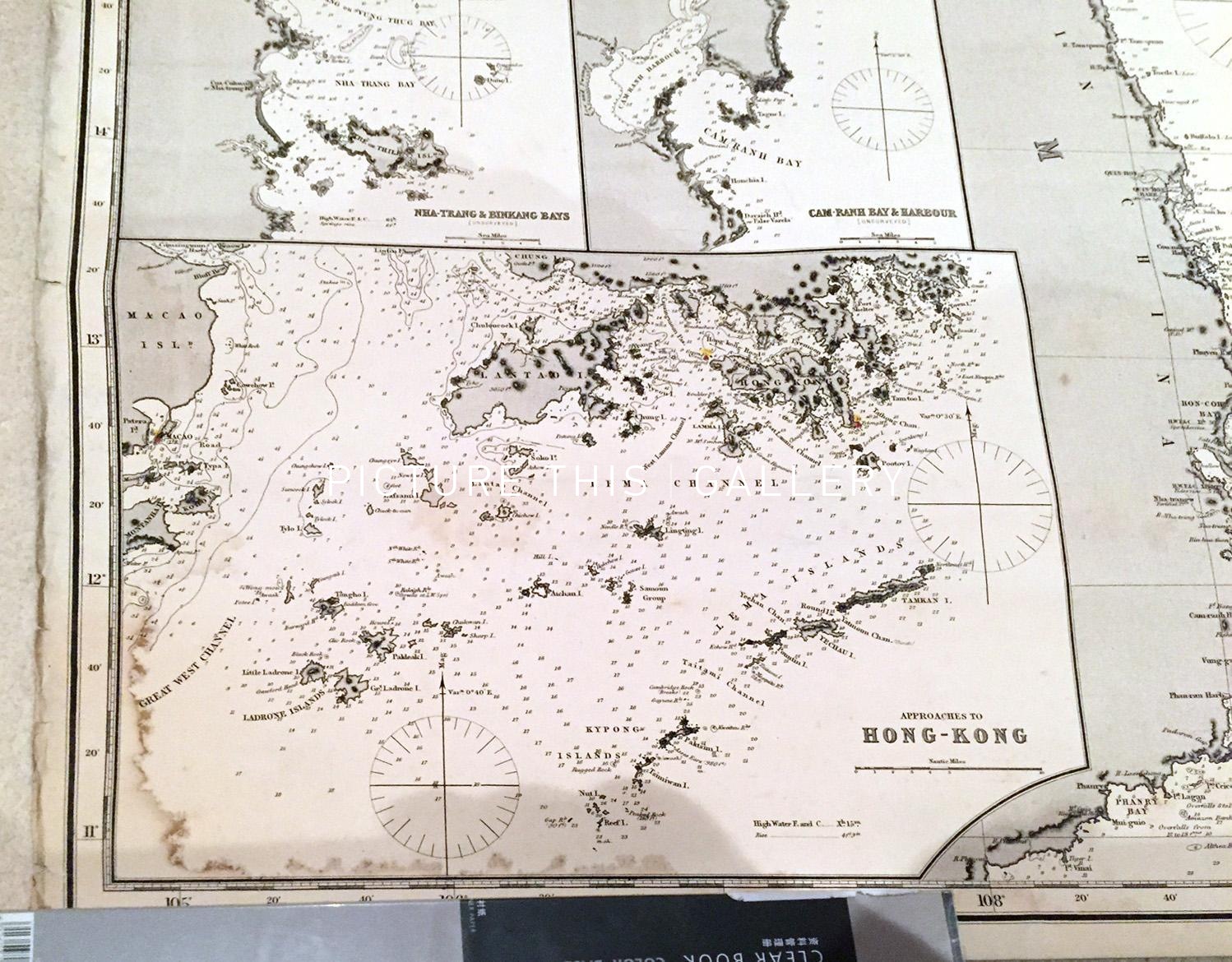
Sea Chart - East India Archipelago - Western Route to China, Chart No.5 (1880)
James Imray; UK Admiralty Chart
London: UK Admiralty
Steel engraving
102cm x 127cm (40" x 50")
1880
Very Good. See details in the description below.
M0449
Steel Engraved Blue Back chart issued in London in 1880. This is a full size chart, 40" x 50" and is backed on blue paper - a "blue-back chart" .
The chart shows the routes to China and Hong Kong from the south, with several inset maps including Hong Kong harbour.
A lovely deep engraving. Small nibble to top border not affecting engraved area. Small waterstain across bottom left corner, intruding a little into the engraved border and map. Overall in superior condition.
1250