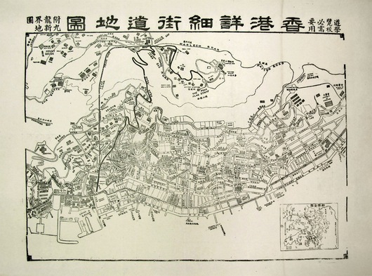
Map of Victoria Hong Kong (Circa 1915)
This map provides lots of interesting information on Central, Mid-levels and parts of the Peak, including marking Peak Road (today Old Peak Road) in bold, naming many of the palatial homes on the Peak and even identifying the School of Anatomy adjacent to HKU.


