Prev | Next
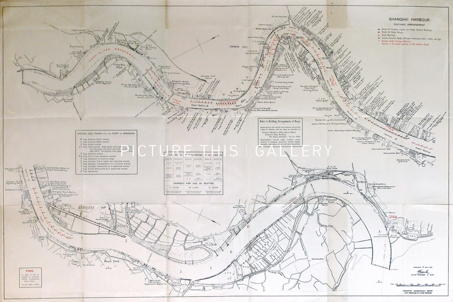
Map of the Shanghai Harbour (1932)
Whangpoo Conservancy Board
37 1/2" x 23 1/2"
1932
M3543
Map of the Shanghai Harbour berthing arrangement proposed by Y. Utne, and issued in July 1932. Shows the Whangpoo River in two sections from the mouth of the river upstream to beyond the city of Shanghai. Marks buoys, wharfs and includes notes on berthing arrangements.