Prev | Next
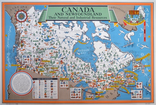
Pictorial Map: Canada and Newfoundland - Their Natural and Industrial Resources (1942)
MacDonald Gill
Alf Cooke Ltd., England
1951 printing of 1942 map
Litho printing
77cm x 50cm
1942
Grade: A. Excellent. Linenbacked. Original foldlines, one vertical and one horizontal.
M1700
Artist: MacDonald Gill
One of three wartime maps designed by MacDonald Gill to promote the war supply efforts of the British Commonwealth. The others are of Australia and New Zealand.