Prev | Next
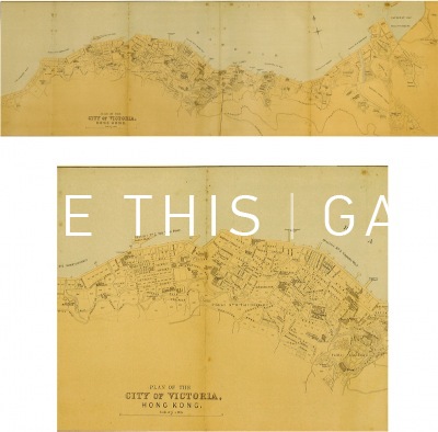
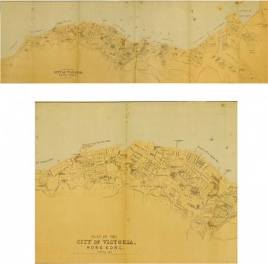
Plan of the City of Victoria, Hong Kong
28.25" x 8.5"
Bartholomew, John
Lithographic map of the north shore of Hong Kong island from Kennedy Town to Causeway Bay. Published in The Directory & Chronicle, circa 1888-90. A rare and important map showing great detail of the streets and harbourfront. (KM011)